
 New Zealand probably stopped being an insider tip years ago. Triggered by Peter Jackson‘s Lord of the Rings trilogy, tourism had a boom in the country at the beginning of the millennium, a trend that continues until today. After finishing school or university, many youths want to spend a year in Australia, or its small neighbour New Zealand. Sadly, this has led to some damage of its nature and the chance of everyone enjoying it without being disturbed. Every summer, hordes of backpackers flock through the countryside, and campers block the frequently winding and narrow streets. You, dear readers, may have already notices that I’m not a big fan of mass tourism and tend to avoid overcrowded places. Nevertheless, New Zealand, with its diverse and beautiful nature and the friendly people, affects me in a special way. At the beginning of this year, I was finally able to fulfil a childhood dream of mine and visited NZ with my kiwi girlfriend.
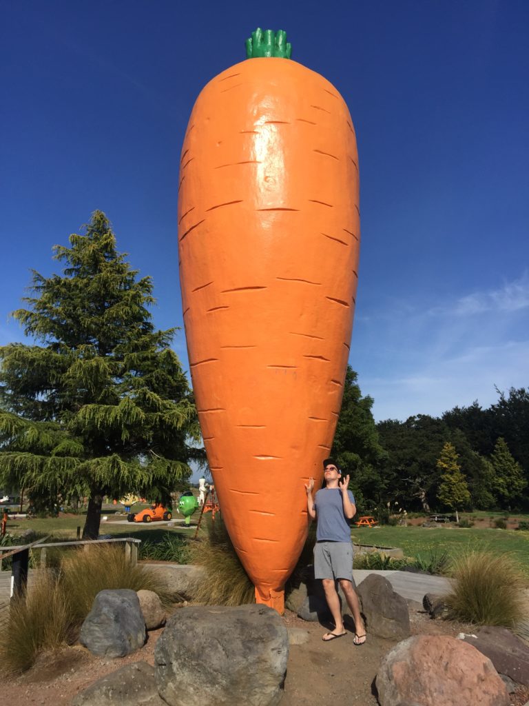
On our road trip through the North Island we stayed in a small bach in Ohakune, which belongs to her aunt. Ohakune, mainly known for the giant carrot on the road into town, is a small village in the Ruapehu District, roughly four hours north of Wellington and just south of Tongariro National Park. It is a good starting point for hikes into the national park, or is a cute stopover on the way up to Lake Taupo. We left the house in the early morning in order to have an adequate amount of time for the hike. Unfortunately, we had not yet stocked up on our supplies and the only petrol station in Ohakune was still closed. With that in mind, we nervously continued our drive on the highway, atmospherically accompanied by a dense fog wall. We were relieved though when after a while, another petrol station emerged from the fog. The little shop in Tongariro National Park Village was every hiker’s wet dream, offering a wide selection of gear and food. Being a hungry pair, we went straight for a traditional ‘mince and cheese’ pie for breaky as well as cereal bars, nuts and plenty of water for the upcoming hike.
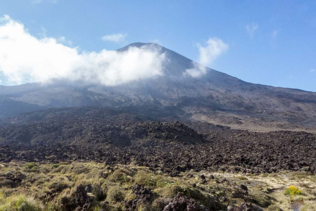 Strengthened and supplied, we continued our drive through the foggy national park – with no chance to see any of the scenic (and partially active) volcanoes – and finally reached the Ketetahi carpark, which was the final destination of the hike. From here, a shuttle bus was supposed to take us to the start of the trail. Although various bus companies warn hikers about limited car parks, we had no problems finding one. Probably because of the fog, we even managed to get one of the free lots along the roadside. Right on time, like a classic German, the small and somewhat old bus picked us up and we raced back over the road into the direction from which we had just come from. Meanwhile, the fog had cleared and opened up the view of the impressive Tongariro panorama. After a small gravel road, the bus dropped us off at the Mangatepopo carpark close to the volcanos, also home to the last proper toilet for a long time.
We started the hike on the well-paved path through black lava landscapes. In front of us lay Mount Ngauruhoe, which was renamed Mount Doom for the Middle-earth trilogy. It was suddenly hot, and the barren landscape offered no shade at all. We gratefully took the optional detour to a small waterfall, which was indicated by a signpost. Here we could treat ourselves to some cool water and refill the water bottles – a good idea, as we experienced later in the day.
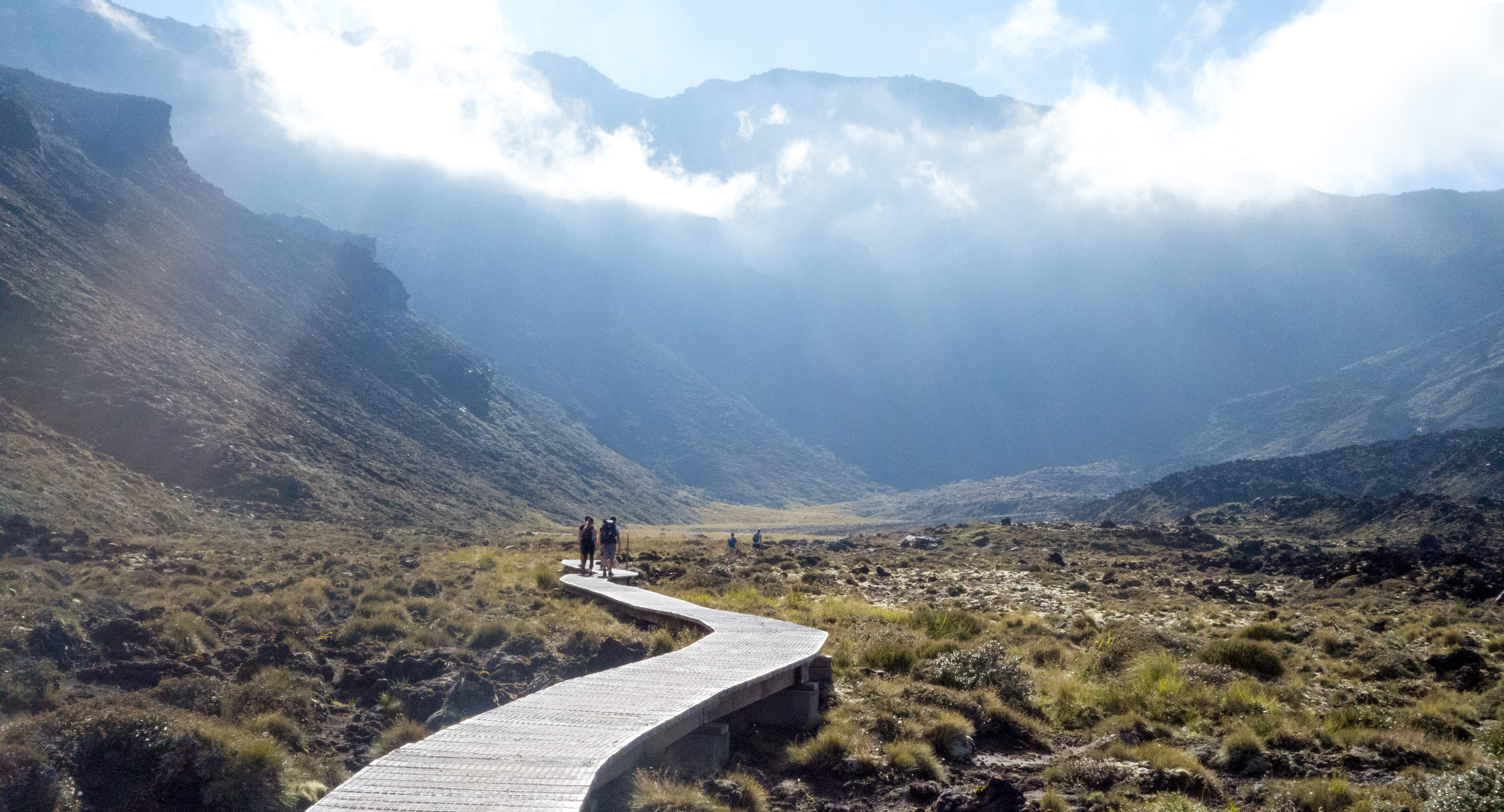
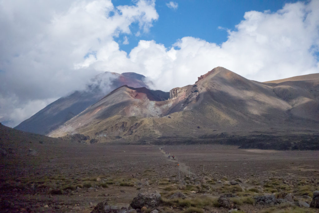
 After a short break, we went on and got closer and closer to the notorious Devil’s Staircase. We now had to overcome nearly 400 meters in altitude via the rocky stairs. Luckily, a cloud found her way to us and saved us from the otherwise deadly heat. Through the cloud we continued up the stairs, surrounded by a big bunch of hikers which sadly spoiled the experience a bit. However, we left many of them behind in the cloud, resulting in us reaching the huge southern crater almost alone. Here, surrounded by steep cliffs, a flat and sandy desert awaited us, heading towards the Red Crater, the highest point of the crossing. Fortunately, there was a good opportunity for a break in the exhausting climb. A small plateau offered us and many other hikers a great view of the southern Tongariro National Park.
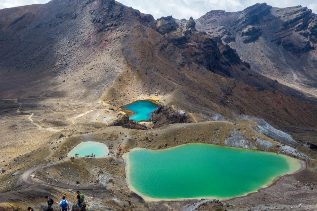
Due to the altitude, the temperature was now very pleasant, which allowed us to have a small snack in peace. Then we continued onto the last climb of the day, up to Red Crater summit. From here, for the first time we were able to catch a glimpse of the days highlight: The Emerald Lakes. These three, steaming volcanic lakes with their sulphurous shores and turquoise water shimmered in the sunlight in a variety of shades. A really wonderful and almost magical view! However, the way down to the lakes was also the only real unpaved part of the trail, the terrain was steep and consisted mainly of loose stones and sand, which meant you had to be careful not to fall. Nevertheless, there was also the opportunity for some great shots.
 Shortly after, we arrived at the Blue Lake, whose Māori name I can unfortunately neither pronounce nor spell. This lake had a different, deep blue colour and was much larger than the small Emerald Lakes, but without the strong smell of sulphur that usually accompanies volcanic lakes. From here, the vegetation started to change again, leading to us walking through grassy hills. The trail continued downhill in a serpentine fashion, and with the altitude sinking, the temperature got warmer again. As a result, we noticed that our water supplies were coming to an end. However, the Ketetahi hut was within our sight, where we hopefully could refill our bottles or even better, buy ourselves a refreshing cold beverage. The wooden hut though, sadly, turned out to be locked, only serving as an emergency shelter since the last volcanic eruption in 2012 … crap! Instantly we regretted our lack of knowledge about the trail, even though we live in a world with the so-called Internet.
Pragmatically, the last water supplies were now strictly rationed, although the parking lot was already “in sight” – in front of us, but far down in the valley. As a truly welcome change, the vegetation around us got higher and higher and the alpine landscape gave way to dense and shady bushes. Unfortunately, we were now without orientation, everything looked the same, and the way through the jungle seemed to be endless. Strangely, although we probably walked down the trail through the trees for just an hour, without any orientation in the landscape it felt like at least double that amount of time. Without the small waterfall at the beginning of the hike, we would have certainly been dehydrated at this point. Finally, after an eternity or two, the forest cleared up and we reached our car and the opportunity to get a drink at our favourite petrol station. Who would have thought that a cold coke could taste so good? A bit wistful, but also very exhausted we made our way back, passing the volcanic range one last time. An amazing hike which I would recommend to anyone, regardless of their hiking experience.